There is a moment on the edge of M’Hamid when the question becomes physical.
The paved road is behind you. Ahead, the ground opens into tracks, gravel, dunes and distances that do not offer an obvious direction. There is no painted line to follow, no road sign at the next bend, no blue arrow on a screen telling you where the surface becomes uncertain. A vehicle can continue only because someone knows how to read what appears, from a distance, to be the same ground everywhere.
How did people know where to go before there was a road?
The question sounds like a question about navigation. In the Draa Valley and the Moroccan Sahara, it was also a question about water, animals, memory, weather, work and relationships. People did not cross an empty desert. They moved through an environment with its own infrastructure: wells, oases, stopping places, cultivated valleys, grazing areas, landmarks, guides and routes learned through use.
M’Hamid El Ghizlane is a particularly revealing place to begin. At the southern end of the Draa oasis sequence, it is where settled palm-grove life meets the routes toward the open desert. Its historical importance does not depend on a single legendary caravan road. It lies in the relationship between a final oasis, a networked valley and the spaces beyond it.
When there was no road
A modern road is easy to recognise because it is engineered to make movement legible. Its surface is standardised. Its direction is marked. Its bridges and bends are designed for repeated traffic. Maps can name it, and vehicles can measure their progress along it.
A pre-modern desert route worked differently. It might be a corridor between known water points, a line that shifted with sand, a seasonal passage for herds, or a remembered sequence of landmarks. It could be visible in places and indistinct in others. Its reliability came not from asphalt but from collective knowledge: who had travelled it, where water could be found, what animals could carry, and when weather made the journey unsafe.
This was not an easier system. It could be slow, physically demanding and vulnerable to failure. A well might be dry or inaccessible. A storm could alter the ground. An animal could become ill. A political dispute could make a route dangerous. Information moved more slowly, and help was farther away. The absence of a road did not create freedom from infrastructure; it made infrastructure less visible and more dependent on people.
The route, in this sense, was part geography and part memory. It existed in the landscape and in the minds of those who knew how the landscape connected.
M’Hamid before the modern road
M’Hamid lies in the lower Draa Valley, in southeastern Morocco. The Draa is not one uninterrupted green strip but a chain of oasis zones, with the M’Hamid oasis at its southern end. The Middle Draa Project describes the valley’s middle section between Agdz and M’Hamid as one of the most fertile oasis areas in the Sahara and identifies Mhamid as the final palm-grove zone in a sequence that includes Mezguita, Tinzouline, Ternata, Fezwata and Ktawa.
That geography shaped movement long before modern transport. The valley’s water supported palms, smaller crops and settlements. The cultivated belt offered food and shelter. Beyond it, routes continued toward more open desert. A traveler moving south did not leave one world and enter another. The oasis was part of the travel system that made movement beyond the oasis possible.
Archaeology gives the valley a deeper history than the popular image of a caravan stopping at the last palms. Satellite survey and fieldwork have located hundreds of archaeological sites, including hilltop settlements, oasis settlements, cairn cemeteries, irrigation systems and dispersed habitation. The Middle Draa Project reports evidence of protohistoric oasis farmers, rock-art sites, medieval town sites, fortified ksour and abandoned oasis gardens.
The chronology is complex. Many earthen fortified sites are not fully dated, and the archaeological record remains incomplete. That uncertainty is useful to state because it prevents an easy story in which every wall is assigned to a famous caravan age. M’Hamid’s built landscape should be read as evidence of long occupation, adaptation and change, not as a backdrop for an invented historical scene.
A 2017 study of M’Hamid’s oasis describes the area as the last oasis of the Middle Draa and examines changes in vegetation between 1984 and 2016. It reports a 22 per cent loss of oasis area and a 21 per cent decline in inhabitants over the study periods, associating the changes with drought, rainfall irregularity, dam effects, tourism and outmigration. These figures describe a recent research period, not the pre-road past, but they show why the oasis remains central to any history of movement. When water and cultivated land change, routes and settlement patterns change with them.
The desert had routes — just not asphalt
It is tempting to imagine the pre-road Sahara as a blank between major cities. Historical geography suggests something more structured. The Wadi Draa runs from the Anti-Atlas toward the edge of the Sahara and then turns west toward the Atlantic. In its middle section, escarpments and narrow passages divide the oasis into zones. These pinch-points could control access from one stretch of the valley to the next.
The Draa’s geography made it a corridor. Scholarly research describes it as an important secondary route for caravans coming from the south toward the Atlas passes and Marrakech, while identifying Sijilmasa in the Tafilalt oasis farther east as the major medieval Moroccan centre of Saharan trade. This distinction is essential. The Draa was connected to long-distance movement, but M’Hamid should not be presented as a universal centre through which every trans-Saharan caravan passed.
The medieval Sahara supported major networks linking North Africa, the Sahel and the Mediterranean world. Museum and university materials describe gold, salt and enslaved people among the principal commodities of that economy, alongside ceramics, copper, glass beads, ivory, leather and textiles. Such a list belongs to the wider history of trans-Saharan exchange. It does not prove that all of these goods passed through M’Hamid, or that every local traveler was a merchant.
Different people moved for different reasons. Merchants carried goods and sought markets. Pastoralists moved animals in response to pasture and water. Pilgrims followed religious routes. Farmers travelled between settlements and fields. Guides carried knowledge. Political and military movements followed their own calculations. Seasonal migrants and families moved as opportunities and constraints changed. The word caravan can conceal these differences if it is used for every form of travel.
Oasis settlements supported movement in practical ways. They could supply food, animals, labour, information and shelter. They were not passive rest stops beside a heroic route. Their own agricultural work made travel possible. The relationship was reciprocal but not necessarily equal, and it changed across time.
At M’Hamid, the evidence is stronger for its position within the southern Draa oasis-and-desert system than for a precisely reconstructed commercial route through the town. That is not a weakness. Historical accuracy sometimes means preserving the outline of a connection without filling its gaps with confident detail.
Water was the map
In a city, a traveler can think of a route as a line between two points. In the desert, the route is often a sequence of viable conditions. Water is the most obvious of them.
A well does more than provide drinking water. It determines whether people and animals can remain in a place long enough to travel onward. It affects the size and timing of a journey. It becomes a point of memory and a reason for a route to be repeated. A reliable source can connect otherwise distant landscapes; a failed source can break the connection.
Oases work on a larger scale. They offer water, shade, food, cultivation and human settlement together. A date palm is therefore not just a tree at the edge of a photograph. It signals an agricultural system and a history of labour. The Draa’s palm groves and fields depended on irrigation and careful use of limited water. Around M’Hamid, the final oasis zone formed a practical threshold between cultivated life and the more open routes beyond it.
Water also shaped animals. Camels could carry loads and travel in dry environments, but they did not eliminate the need for water planning. Their endurance made certain journeys possible; it did not make distance irrelevant. Other animals had different requirements. A group’s pace and route depended on the animals it used, the loads it carried and the next reliable source.
This is why knowing direction was not enough. A traveler could know where south lay and still be unable to reach the next destination. The useful knowledge was relational: this route, at this season, with these animals, after this amount of water, under these weather conditions.
Historical travel was therefore planned around uncertainty rather than protected from it. Travelers might wait, alter a route or rely on local information. There was no promise that a line drawn on a map would remain the safest path. The landscape could change, and so could the political conditions around it.
The people who knew the way
A guide in a desert was not simply someone who walked at the front of a group. Guidance depended on accumulated experience: knowing terrain, water, weather, places of passage and the limits of the travelers and animals. It could include reading tracks, recognising landmarks, remembering the relation between an oasis and the open desert, and understanding where a route was usable at a particular time.
This knowledge was social. It moved through families, work groups and relationships between communities. A person might learn by travelling, observing, listening and carrying responsibility. Some knowledge could be written or mapped; much of it could be transmitted orally or through repeated practice.
Research on Moroccan pastoralism distinguishes nomadic, semi-nomadic and transhumant forms of movement. In the pre-Saharan and Saharan south, mobile pastoralism has persisted in different configurations, while schooling, healthcare, borders, land change, drought and employment have reshaped older patterns. The historical traveler’s knowledge should not therefore be imagined as a property of a single ethnic group or a vanished class of “desert people.” Oasis farmers, pastoralists, guides, traders and settled families all had different relationships with the terrain.
Amazigh history is relevant to many southern Moroccan communities, including regional research on Aït Atta and Aït Khabbash, but it does not justify assigning every person around M’Hamid to one identity. Arab, Amazigh, Sahraoui, oasis, mobile and settled categories overlap in some histories and differ in others. The most responsible account names a group only when the evidence supports its connection to the place being discussed.
Navigation could include landscape features and celestial observation, but specific practices must be treated carefully. Regional ethnoastronomy research documents astronomical vocabulary among Ayt Xebbac speakers in Tabelbala, southwestern Algeria, including names for Polaris, Orion, Sirius, the Pleiades and the Milky Way. The study has regional relevance because it discusses genealogical ties to the Aït Atta confederation of southeastern Morocco, but it is not evidence that the same terminology or techniques were used universally in M’Hamid.
The safest conclusion is that desert navigation was multi-layered. Stars, Sun, landmarks, wells, tracks, animals, memory and experienced guides could all matter, but no single “ancient navigation secret” explains the region.
Crossing distance without modern technology
A long journey before roads required organisation. Supplies had to be carried, animals selected, water planned and departure timed. A group needed to know where it could stop and what might happen if the journey took longer than expected. Distance was measured not only in kilometres but in the capacity of bodies, animals and water sources.
Camels became important to Saharan transport because they could carry loads and function in dry environments. Their use belongs to wider African and Saharan histories, and it would be misleading to treat every camel journey as a commercial caravan. A family moving between seasonal places, a pastoral group following grazing, a pilgrim, a merchant and a military column did not have the same purpose or organisation.
Communication was also different. News about routes, water or insecurity could move through personal networks, markets, settlements and travellers. A route might be safe one season and less safe in another. Political authority was uneven, and the ability to travel depended on more than physical geography. Borders, conflict, tolls, alliances and local power could change the practical meaning of a route.
The absence of modern infrastructure did not mean an absence of planning. It meant that planning was distributed across people and places rather than embedded in an engineered road. A well performed one function of infrastructure. An oasis performed several. A guide, a reliable animal and a remembered stopping place were also part of the system.
This system demanded skill, but it also imposed hardship. Travel could be slow. Weather could interrupt movement. Injury or illness could become serious. A group could be dependent on a single water source. There was no emergency service waiting beyond the horizon. Respect for historical knowledge should not become nostalgia for these conditions.
When roads changed the desert
The arrival of roads and motor vehicles did not begin human movement in the Draa Valley. It changed its speed, scale, risks and destinations.
A vehicle can carry water, food, tools and people in quantities that would alter the planning of an animal journey. A road can connect an oasis to towns, schools, clinics, markets and administrative services. It can make it easier to leave, return, transport goods, seek medical help or build a livelihood connected to tourism. A phone can transmit a location that once had to be explained through a chain of remembered landmarks. GPS can reduce the risk of missing a track, even when it cannot explain the social or environmental meaning of a place.
Modern mobility has also changed settlement and work. Research on Moroccan pastoralism describes families settling to secure education and healthcare and documents the decline or transformation of mobile herding in several regions. Research on Aït Khabbash communities in the wider Draa-Tafilalet region links restricted mobility, drought, migration, settlement and community-led tourism. These studies should not be treated as a biography of every M’Hamid family. They show the kinds of pressures and choices that have reshaped the wider region.
M’Hamid’s modern economy includes agriculture, local commerce, transport, guiding, accommodation, crafts and tourism. The road makes some of these activities possible at a scale that older routes did not. It also changes the visitor’s perception. A traveler can arrive by asphalt and feel that the desert journey begins only when the vehicle turns onto sand. Historically, the geography was already connected before that moment.
The paved road is not the opposite of the old route. It is a new layer over an older geography of movement. It makes some routes visible and standardised, while other forms of knowledge remain local and experiential.
A road is not the beginning of a journey
Today, a visitor to M’Hamid may follow the N9, arrive at the oasis, continue by 4x4 or camel, and spend a night in a desert camp. This is a modern journey, with modern expectations and modern equipment. It should not be disguised as a reconstruction of pre-road travel.
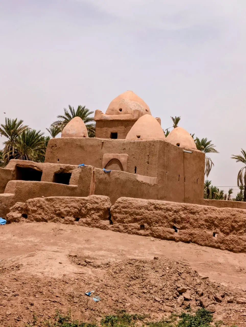
But the journey passes through a landscape shaped by older connections. The palm grove still marks the importance of water. The ksour still show how settlement occupied the oasis. The track toward the dunes still depends on terrain, weather and local knowledge. A guide still adds information that a map cannot supply. The communities that make travel possible existed before tourism, and they continue to make choices within the present.
To travel respectfully is to understand that the desert is not a blank waiting for a visitor’s story. Ask local guides about the places you cross. Respect private homes, camps and agricultural land. Ask before photographing people. Support locally owned services where possible. Do not treat a camel, a worker or a resident as scenery arranged for an outsider.
Before roads, people crossed the region through an infrastructure made of water, animals, routes, settlement and knowledge. Roads did not replace all of it. They changed the balance between its parts.
At M’Hamid, the most important historical question is not where the first vehicle drove. It is what the vehicle joined: an oasis, a valley, a desert route and communities that had long known how to move through a landscape without an asphalt line telling them where to go.
A road is visible. A route may be remembered. Both connect places. Neither begins the story.
🐪 Follow ancient desert routes on a long Sahara expedition. long-treks.html → · travel-guide.html →