At night, M’Hamid changes without moving.
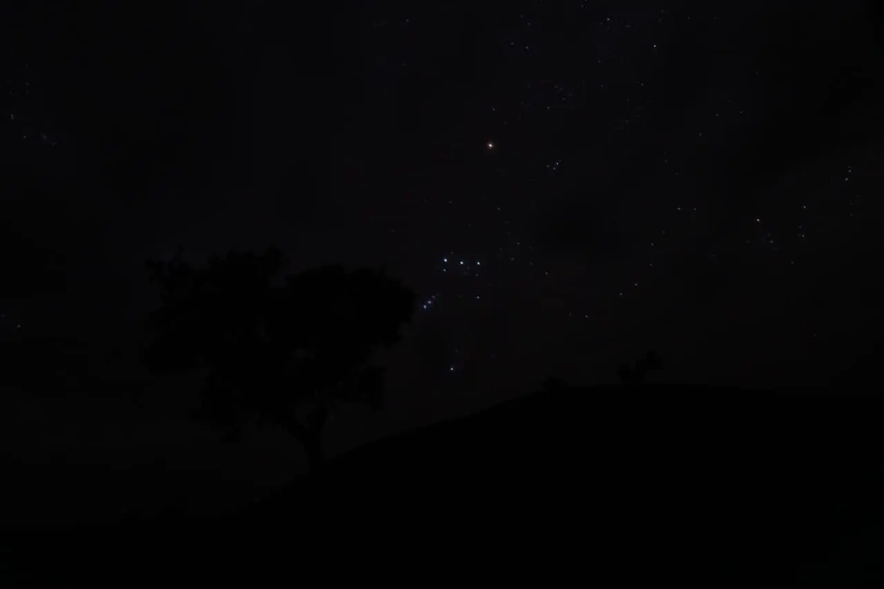
The palms remain where the water allows them to grow. The low walls of the oasis still hold the day’s warmth. A road, a camp or a distant lamp may mark the ground, but above it the scale becomes immense. The first bright stars appear before the last colour has left the sand. Later, if the air is clear and nearby lights are low, the Milky Way can emerge as a pale band rather than a name in a guidebook.
For a traveler arriving from a bright city, this can feel like a discovery. For people who moved through dry country before roads, smartphones and GPS, the sky was not only something to admire. It was one part of a larger environment to read.
That distinction matters at M’Hamid El Ghizlane. The southern end of the Draa oasis is now a departure point for desert journeys, but it is not an empty threshold between a town and a tourist landscape. It is a place where agriculture, pastoral movement, routes, water and memory have met for generations. To ask how people once read the stars is therefore to ask a wider question: what did it mean to know the sky before an electronic screen could tell you where you were?
The sky was part of the landscape
Modern life separates the sky from the ground. We use one map for roads and another application for weather. We check a clock for time and a calendar for seasons. In a desert, these divisions are less secure. The direction of the wind, the shape of a ridge, the condition of a well, the arrival of a moon phase and the position of a bright object overhead can belong to one practical conversation about movement.
M’Hamid is especially suited to thinking about this relationship because it sits at the southern end of the Draa Valley’s oasis sequence. Irrigated palms and cultivated plots do not simply stop being part of the desert; they show how people have organised limited water within an arid environment. Beyond the oasis, the open ground toward the deeper Sahara demands another kind of attention. Routes depend on more than distance. They depend on water, terrain, pasture, weather, animals and knowledge of who uses which places.
The history of the Draa is not a story of people looking upward in isolation. Archaeological work in the Middle Draa has shown a long relationship among movement, settlement and oasis agriculture. The valley’s history includes farmers, herders, travellers, traders and communities whose lives cannot be reduced to one category. The night sky belonged to this social landscape. It might be observed by a shepherd, a farmer, a guide, a scholar or a traveler, but its meaning would not necessarily be identical for each person.
This is also why it is risky to speak of “the desert people’s astronomy” as though the Sahara had one inherited system. The Sahara contains many societies and languages. Knowledge varies between regions, communities, occupations and generations. A star that is central to one tradition may be less important in another. Some knowledge is practical, some linguistic, some religious, some seasonal, and some may no longer be remembered in detail.
Direction without a screen
The night sky can provide orientation because Earth turns beneath it. Stars appear to rise, move and set, but their patterns change in regular ways. The star Polaris, near the north celestial pole, can indicate the northern direction in the northern hemisphere. The Sun’s apparent movement can help establish the broad relationship between east, west, morning and afternoon. The Moon provides changing light and a repeating cycle, although its phase and position must be interpreted in relation to the date, latitude and time.
These are astronomical facts, not proof of a particular local custom. A traveler should not assume that every M’Hamid guide or every historical herder used Polaris in a formal navigation method. The published evidence for specific local practice is limited. What can be said more confidently is that celestial orientation has been documented in wider Saharan and North African contexts, and that a sky without artificial lighting offers far more visible information than the sky above a city.
The stars would also have been only one layer of travel knowledge. A person crossing dry country did not navigate by constellation alone. Direction was related to remembered routes, wells, dunes, mountain silhouettes, wind, ground texture, tracks and the condition of the animals. Daylight observations and local landmarks mattered. So did social knowledge: where a group could camp, which water source was reliable, and how seasonal conditions changed the landscape.
A GPS receiver can provide coordinates. It cannot tell a visitor whether a track is safe after a storm, whether a well is available, whether a campsite is used by a family, or how to approach a community respectfully. That is not an argument against technology. It is a reminder that location is not the same as understanding.
The sky as clock and calendar
Celestial observation can also organise time. The Sun marks the changing length and direction of shadows. The Moon divides the month into visible phases. Stars return to the night sky in seasonal patterns, although their exact visibility depends on latitude, horizon, weather and the time of night. Such observations can support a broad sense of when conditions are changing.
Traditional methods should not be described as if they were uniformly precise. A sky-based calendar is not necessarily a clock with minute-by-minute accuracy. It may be a practical way to recognise a season, anticipate a period of travel, organise agricultural work or remember the return of a familiar celestial pattern. Weather and local ecology remain decisive. A star can suggest a season; it cannot replace knowledge of rainfall, pasture or water.
This relationship is clear in the Draa Valley, where oasis agriculture and pastoral movement have always depended on environmental timing. Planting, harvesting, grazing and travel are shaped by conditions on the ground. The sky may help structure attention to those conditions, but it does not operate separately from them.
Research on Saharan livestock-keepers warns against imagining a single, distinctive pastoral view of the sky. Clare Oxby’s review argues that pastoral societies are part of complex worlds that include farmers, towns and markets. It also suggests a broad difference between literate traditions, where seasonal stars may have a marked role, and oral traditions that may rely more heavily on seasonal moons. The lesson is valuable for M’Hamid: knowledge is not a museum system called “nomadic astronomy.” It is a set of practices shaped by language, work, movement and social life.
What the names of stars can tell us
The strongest accessible study of regional Amazigh astronomical vocabulary is Lameen Souag’s research on the Ayt Xebbac of Tabelbala, in southwestern Algeria. The group discussed in the study includes former nomads with genealogical connections to the Ayt Atta confederation of southeastern Morocco. Souag records terms for several celestial objects, including Venus, Polaris, Orion, Sirius, the Pleiades, Aldebaran, Canopus and the Milky Way.
The study is important partly because it is precise about its limits. It concerns a particular community and language situation. It is not evidence that the same names were used by everyone in M’Hamid. It does, however, show why language matters when discussing the night sky. A celestial object is not only a point of light. It can be classified through a local vocabulary, compared with an animal or landscape feature, and carried through memory even after a mobile way of life has changed.
Souag discusses *amanar* as a term associated with Orion and with the idea of a guide, while *asif n yigenna* describes the Milky Way as a “river of the sky” in the material he records. These are documented regional linguistic details, not stories to be transferred automatically to M’Hamid. They should invite better local questions rather than provide ready-made folklore.
If a traveler wants to learn the names of stars around M’Hamid, the respectful approach is simple: ask a local guide what people here call them, who uses those names, and whether the terms are old, contemporary, Arabic, Amazigh or borrowed across languages. The answer may be more interesting than a rehearsed legend because it reveals how knowledge actually moves between people.
Learning through movement and memory
Knowledge of the sky is learned by looking, but looking is not enough. It is learned in relation to a route, an animal, a season and a person who knows more. A child may notice the same bright object many times before understanding its name or relevance. A young guide may learn the ground from older relatives and later combine that knowledge with a vehicle, a map application and a satellite phone. A herder may know a territory through pasture and water rather than through formal astronomical vocabulary.
This kind of knowledge is often embodied. It lives in when someone leaves camp, how they recognise an approaching change in weather, how they distinguish a familiar ridge from a misleading one, or how they decide that a route should not be attempted. It may be expressed in conversation rather than written down. It may be revised when roads, borders, drought and employment change the possibilities of movement.
That change should not be confused with disappearance. Modern education, medical care, roads and communications have brought real opportunities. Families make choices in response to those opportunities and to constraints. In southern Morocco, research describes several forms of pastoral mobility, including nomadic, semi-nomadic and transhumant practices, while also documenting pressures from settlement, schooling, healthcare, land change and drought. A person can live in a town and retain deep knowledge of desert routes. A family can use GPS and still teach a child how to read the landscape.
When roads and GPS changed the desert
A road changes more than travel time. It changes which places are connected, how supplies move, where schools and services are reached, and how a journey is planned. Vehicles reduce the need to carry every necessity on an animal. Maps make routes easier to compare. Smartphones allow a guide to communicate with a driver, check weather information or share a location. GPS can reduce the risk of losing a track and help emergency services find a vehicle.
None of this makes older knowledge foolish. It changes the situation in which that knowledge is used. A guide may know the desert through family experience and use a phone as an additional tool. A traveler may follow a digital route and still fail to understand why a certain well, track or camp matters. Technology answers some questions quickly. It does not answer every human question.
Artificial light has changed the night in another way. The National Park Service defines skyglow as the brightening of the night sky caused by artificial light scattered in the atmosphere. This reduces contrast and makes stars and planets harder to see; dust, aerosols, moisture and clouds can increase the scattering. Remote areas can therefore offer better conditions for observing stars when nearby lighting is limited and the atmosphere is clear. This is a matter of visibility, not a claim that every night in M’Hamid is cloudless or that the region holds an official world record for darkness.
NASA notes that the Milky Way appears as a faint band in dark locations away from bright city lights because we observe our own galaxy from within its disk. The difference between a city night and a desert night is therefore not only emotional. It is optical. In a city, skyglow washes out faint contrast. At a remote camp, more of the existing night sky can reach the eye.
The desert night at M’Hamid today
A modern desert camp is not a reconstruction of a pre-electric world. It may have solar power, vehicles, mobile reception, kitchens, bathrooms and guests who arrived after looking at a digital map. Its lights may be carefully managed or they may be brighter than a traveler expects. The experience of darkness is shaped by practical choices made by hosts, guides and visitors.
The best way to observe the sky is not to demand a performance from the desert. Give the eyes time to adapt. Use a dim, shielded light when necessary. Move away from unnecessary lamps without creating a safety risk. Remember that a bright Moon changes what can be seen: it reveals the ground but can make faint stars and the Milky Way less visible. Dust or haze can also reduce clarity. A dark site improves the chance of seeing more stars; it does not guarantee a perfect view.
A local guide adds a dimension that an astronomy application cannot. The guide can explain the direction of the oasis, the relation between a camp and a track, the history of a settlement, or the practical reason for stopping at a particular place. The guide may also say, honestly, that a certain star name is not used locally or that a popular tourism story has been repeated without evidence. That honesty is part of the experience.
Travelers should ask before photographing people, homes or camps. They should listen rather than assume that a person who works with visitors represents every desert community. They should support local guides and businesses where appropriate, pay fairly, and remember that hosts are individuals with their own choices. The night sky is shared; the people beneath it are not attractions.
What we have forgotten
For many visitors, the stars begin as scenery. They become more meaningful when we understand that the boundary between scenery and knowledge has not always been so clear.
A sky can indicate direction without providing a complete route. A moon can mark a cycle without explaining the weather. A familiar star can carry a name without belonging to one universal mythology. These limits do not make celestial knowledge less impressive. They make it human: partial, practical, learned through experience, and adjusted to circumstances.
At M’Hamid, the question is not whether travelers can recover the exact sky-reading system of their ancestors. In many cases, the evidence is too local, too varied or too poorly documented to make that claim. The better question is what becomes visible when we stop treating the stars as decoration. We see the relationship between sky and water, between direction and memory, between movement and place.
Modern technology has not taken the sky away. It has changed what we ask of it. We no longer need every star to find a road. We can still learn to look carefully enough to understand that a road is never only a line on a screen.
🐪 Spend a night reading the desert sky on a short camel trek. short-treks.html → · travel-guide.html →